|
KMS FROM OPOTIKI
43KM
|
Welcome to Ohope Beach |
KMS FROM WHAKATANE
7KM
|
Ohope is a world renowned holiday spot that has 11 km of beach from West End, a favourite surfing spot, to Ohiwa Harbour mouth at the eastern end. Ōhope has plenty of holiday accommodation including Beachpoint Apartments (see advert below) and Ohope Beach Top 10 Holiday Park, and a small shopping area.

|
Beachpoint Apartments: 5 West End, Ohope. Sublime beachfront apartments
P: 0800 BEACHPOINT E: beachpoint@wave.co.nz |
|
www.ohopebeach.info: Local Online Directory. Accommodation. Activities. Essential information.
|

Harbour Road
State Highway 2 turns inland at the junction with Harbour Road. This sandspit is the western arm of the Ohiwa Harbour, there is beach and harbour access, accommodation a plenty at the Ōhope Beach Top 10 Holiday Park, a wharf and boat launching.
State Highway 2 turns inland at the junction with Harbour Road. This sandspit is the western arm of the Ohiwa Harbour, there is beach and harbour access, accommodation a plenty at the Ōhope Beach Top 10 Holiday Park, a wharf and boat launching.
|
Ohope Beach Top 10 Holiday Park: 367 Harbour Rd, Ph 0800 264 673
|

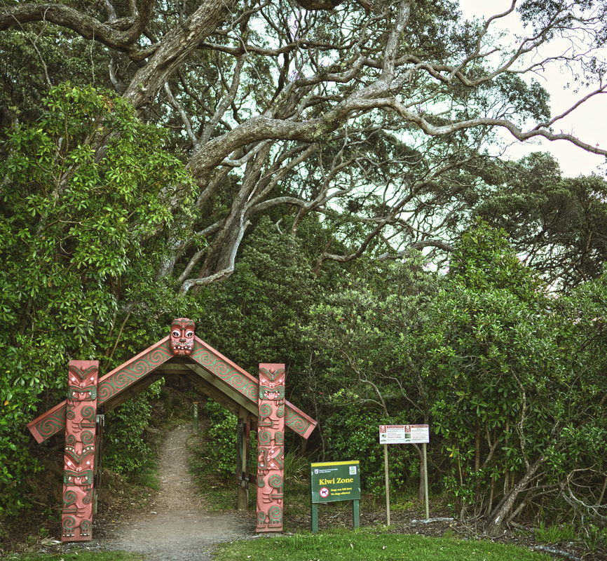
Ohope Scenic Reserve Walkway Entrance
– Photo NR Hutton
|

Kids enjoying Ōhope Beach.
- Courtesy of Whakatāne i-Site.
|
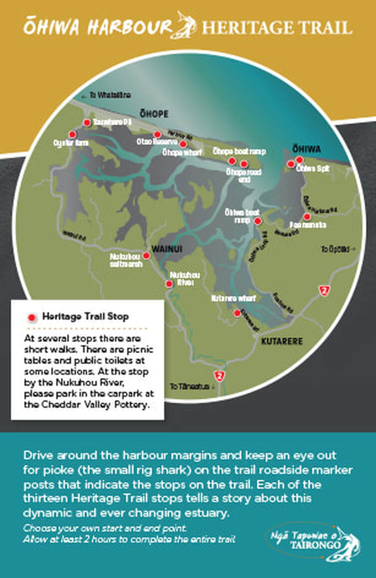
Ōhiwa Harbour Heritage Trail, Ngā Tapuwae o Tairongo
Take a journey of discovery of Ōhiwa harbour’s natural environment and human history. Begin your exploration from Ōhope boat ramp or Ōhiwa Spit before making your way around the 13 signposted stops. At each stop you’ll find interpretation panels describing the special features, flora and fauna and sometimes a short walk.
There are large maps showing the route at either end of the trail: at the Ōhope boat ramp and the Ōhiwa Spit. Pamphlets with more information are available from local I-sites and campgrounds.
|
Back on the Pacific Coast Highway, 300 metres on the left you will find the entrance to Tauwhare Pā Scenic Reserve. Climbing up from the roadside carpark, visitors are met with panoramic views of the Ohiwa Harbour, Ōhope Spit, and White Island on the horizon. A significant historical site, Tauwhare pā was built by Te Hapuoneone, an ancient tribe from which many of today's iwi descend. The name Tauwhare implies 'the village suspended in space'. When viewed from the bottom of the southern end of the pā, the village gives this impression. Continuing on, the Ohiwa Harbour and the Oyster Farm come into view. This harbour, apart from its natural beauty, has great biological significance both for its flora and fauna and is a great source of kaimoana. Also it has endless potential for recreation.
|
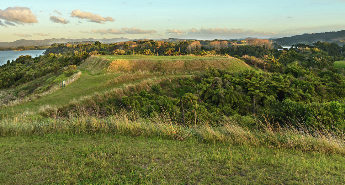
Tauwhare Pa - Photo NR Hutton
|
|
The road continues to follow the harbour, on the right you pass Te Kooti Road named after a well known historical figure. Further on is the site of the old Wainui School. At Burke Road, on the left is the Saltmarsh Lookout, with a picnic area and boardwalk, which overlooks the largest remaining saltmarsh in the Harbour. Unique displays of the rare bird life found here form part of this public area. The Cheddar Valley Walk also starts here (2km one way – 4km return).
The road continues along the edge of the harbour on the right you will come across the old Cheddar Valley Co-op Dairy Co. building, used for eleven years before amalgamation with Ōpōtiki Co-op. In its heyday it processed the milk from 300 cows and is now used by Cheddar Valley Pottery, which is well worth a visit. |
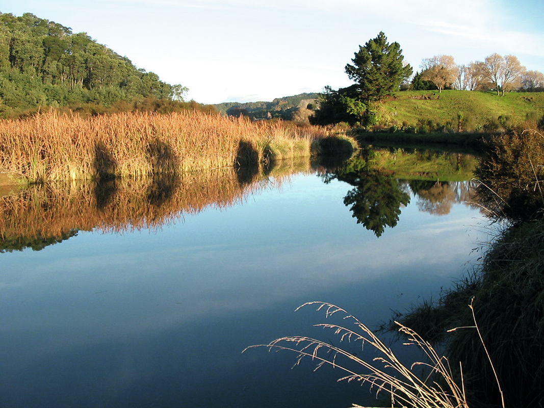
Views from the Cheddar Valley Walk - Photo Stuart Slade
|
|
Cheddar Valley Pottery
1034 Wainui Rd. Domestic and garden ware. Tiles. NZ designs. Working studio. EFTPOS. Stuart & Margaret Slade. Open most days. P: 07-312 4583 |
The road follows the Nukuhou Stream till it meets SH2 again at the Matekerepu Bridge.
|
20km
|
Kutarere
|
30km
|
The settlement of Kutarere once the port town of Ohiwa Harbour that serviced the hinterland, is steeped in Māori history with recent major renovations to the local marae.
Travelling eastwards still with the harbour on your left, Ruatuna Road, just 2 kilometres on, provides an interesting detour.
Travelling eastwards still with the harbour on your left, Ruatuna Road, just 2 kilometres on, provides an interesting detour.