Site Search
|
KILOMETERS FROM OPOTIKI
|
KILOMETERS FROM WHAKATANE
|
|
77km
|
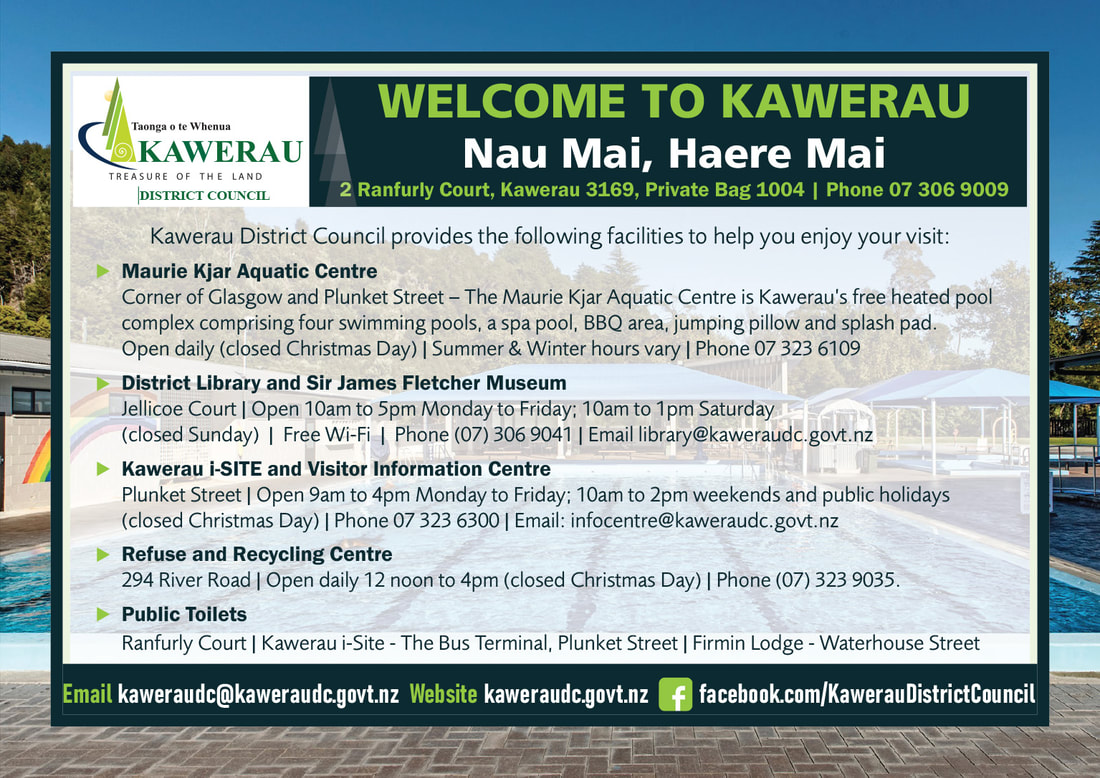
Welcome to Kawerau
|
33km
|

Kawerau is nestled beneath the ancient volcano, Putauaki which can be seen all the way from Te Kaha. Kawerau is renowned for its wonderful climate and its multi-cultural Heritage and has the distinction of being one of the youngest towns in New Zealand. Founded in 1953 the township has been well planned with plenty of parks and reserves, wide tree-lined streets and a leisurely pace of life.
Initially developed to cater for the pulp and paper industry, Kawerau's geothermal capacity and access to an abundance of natural resources led to diversification and the establishment of specialised industry. Kawerau's unique business environment makes it the logical site for sustainable industrial development.
Motorhome friendly Town: Kawerau has two designated areas for freedom camping for self-contained vehicles. These areas are Firmin Field and Prideaux Park which both have a dumping station. Visit the team at the Kawerau i-SITE if you need access to power. Freedom campers are welcome to stay in the Kawerau District for up to seven nights in any one calendar month with the first three nights FREE.
|
Kawerau i-Site
At the Bus Terminal, Plunket St. Permits to Tarawera Falls & trout fishing. Daily walking tours of town & parks. P: 07 323 6300 |

Kawerau Business Directory
|
Gateway Funeral Services
24 hours. 2-4 Ranfurly Court. Ph 07 308 6102. E: [email protected]. W: www.gateway.funeral.co.nz Kawerau i-Site
at the Bus Terminal, Plunket St. Permits to Tarawera Falls & trout fishing. Daily walking tours of town & parks. Ph 07 323 6300. New World Kawerau
Open 7 days. Tarawera Court. |
Kawerau Accommodation
|
Firmin Lodge
Modern affordable group accommodation. Waterhouse St. P: 07 306 9009 |

Kawerau Cafe's & Restaurants
|
Beyti’s Turkish Cafe & Restaurant
Open Tuesday to Sunday. 23 Liverpool St. Ph Beyti or Averill. P: 07 219 3954 |

Kawerau Activities
|
Kawerau i-Site
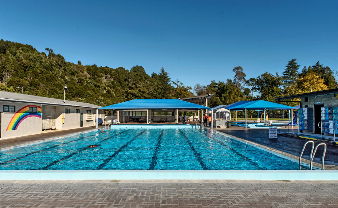
at the Bus Terminal, Plunket St. Permits to Tarawera Falls & trout fishing. Daily walking tours of town & parks. Ph 07 323 6300. Maurie Kjar Aquatic Centre
Cnr Glasgow & Plunket Sts. FREE heated pool complex. Ph 07 323 6109 Rangitaiki & Motu Jet Boat Tours
Adventure & excitement. Suitable for all ages. Ecological & Historical Commentary. Bookings Essential. Ph Mark 027 4707315. |
Maurie Kjar Aquatic Centre