click to see map
|
|
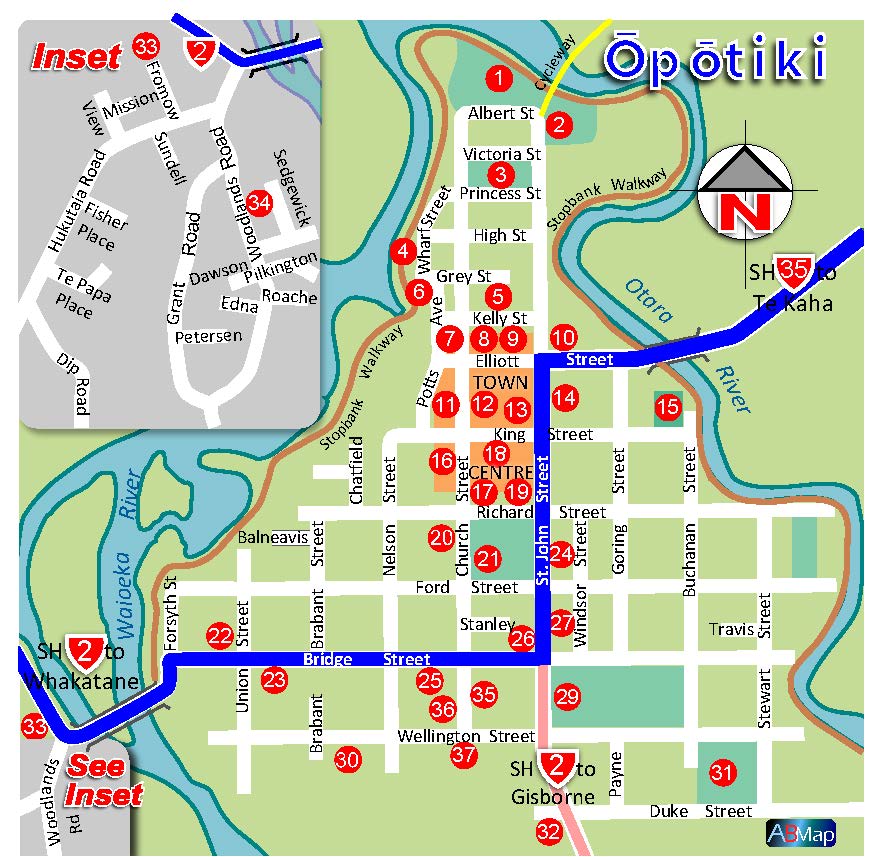
Opotiki Area Map & Street MapThe Opotiki District ranks highly as a hospitable relaxed place in which to spend your holidays.
Located with Rotorua and Tauranga to the north and Gisborne further east, all within a 160km radius. The Opotiki District encompasses a virtual “Sportsman’s Paradise” and one of the finest natural “Family Holiday Playgrounds” in New Zealand. <read more> |
click to see map
|
click to see map
|
|
|
Wairoa Street Map
Wairoa township acts as the vital hub for a huge district. This includes Mahia with a number of beautiful beaches and peaceful holiday homes. A natural playground for people who like to surf, fish, kayak or swim.
<read more> |

click to see map
|
click here to see map
|
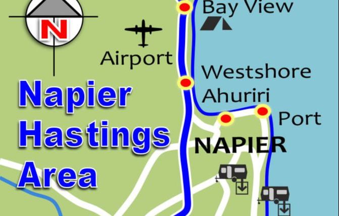
Napier Area Map
Napier is a neat city, popular with vacationing New Zealanders. Beautifully preserved 1930s architecture is Napier’s special point of difference. Napier is known as the art deco city & is maintaining that title these days mainly because of the work of the Art Deco Trust.
<read more> |