
OPOTIKI to GISBORNE via the Waioweka Gorge
STATE HIGHWAY 35 ROUTE TO GISBORNE
|
The Waioeka Journey – Te Awa a Tamatea is situated on State Highway 2 between Opotiki and Gisborne. The highway follows a route carved by rivers through the steep forested hills of the Waioeka Gorge Scenic Reserve. The trip from Ōpōtiki to Gisborne can probably take about two and a half hours but by picnicking or generally messing around anywhere in the delightful bush setting of the gorge the trip can profitably be made to last many hours longer. To start follow State Highway 2 south along St John Street, past the cemetery, continue to the right then you come out onto the Waioeka Flats. This straight road continues until the settlement of Waioeka and the entry into Waioeka Gorge Scenic Reserve (New Zealand’s largest scenic reserve). The gorge has many idyllic picnic spots and can be a fisherman’s paradise when the fish are biting.
‘The Waioeka Journey – Te Awa a Tamatea’, is a multi-agency project where seven rest areas have been established at sites through the gorge to encourage travellers to stop, rest and reduce driver fatigue, a significant contributor to Waioeka accidents. Information panels at each site tell of the history, culture, geology and ecology of the gorge. Stories of the Waioeka Gorge show it is not a place to be taken for granted, but has hidden depths that will delight and challenge people for generations to come. A place with tales of hardship, ingenuity and adaption. Each of the sites has its own story to tell. The two main agencies have been The New Zealand Transport Agency www.nzta.govt.nz and the Department of Conservation. www.doc.govt.nz. View the Waioeka Journey Booklet |

|
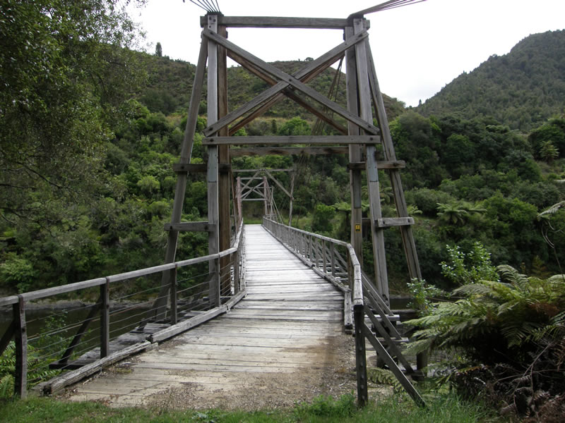
Tauranga Bridge – Barbara Collett
|
|
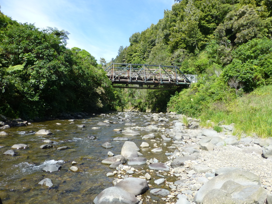
Manganuku Bridge & DOC Campground
|
|
We hope that you enjoyed THE WAIOEKA JOURNEY
|
km from Opotiki
|
km from Gisborne
|
Soon after the road starts to climb out of the gorge and wind its way up over Traffords Hill, at 725 metres the high point in the trip. Just after you cross the bridge and the head waters of the Motu River, you will come across the sculpture Hinetapuarau, showing the connections between Tūranga Iwi (tribe) and Hapū (sub-tribe). A right turn on Te Wera Road would take you through even more scenic back country roads and on to Wharekopae, Rere Falls & Eastwoodhill Arboretum joining SH2 again south of Gisborne. One and a half kms from the SH2/Te Wera Road intersection is the Moanui Road turn off to Moanui - Koranga - Tawa Loop Track or continue on the main road to Matawai.
|
72km
|
Matawai
|
72km
|
Matawai is a small rural settlement with a Cafe & Camp at Matawai Camp - store, art gallery and service station. Matawai is also the junction of two great cycle trails...the MOTU TRAILS CYCLEWAY heads to Ōpōtiki from here or RERE FALLS TRAIL heads to Gisborne, or combine both “Coast to Coast”.
Before you leave the area turn left in the village and visit Motu (14kms from Matawai) where you will find Motu-Vation Cafe and Motu Community House and a bit further on the Motu Falls.
Before you leave the area turn left in the village and visit Motu (14kms from Matawai) where you will find Motu-Vation Cafe and Motu Community House and a bit further on the Motu Falls.
MOTU VILLAGE & MOTU FALLS SIDE TRIP
Matawai is a small rural settlement and the junction of two great cycle trails...the MOTU TRAILS CYCLEWAY heads to Ōpōtiki from here or RERE FALLS TRAIL heads to Gisborne, or combine both “Coast to Coast”.
Before you leave the area turn left in the village and visit Motu (14kms from Matawai) where you will find Motu Community House and a bit further on the Motu Falls
On leaving Matawai the road to Gisborne follows the old railway track down through some majestic hill country that borders Te Urewera. Another 16kms further on you will come across Makaretu Road where you will find Haurata High Country Retreat and Farm Walks.
|
Haurata High Country Retreat and Farm Walks
Experience Gisborne’s most spectacular scenery and accommodation. 658 Makaretu Rd, Otoko. P: 06-867 8452 E: [email protected] W: www.haurata.co.nz |
Otoko
This is the western end of the Heritage Trail Walkway. The 5km walkway follows the old Gisborne to Motuhora railway, taking 2 – 3 hours walk, suitable for all ages. Closed 1 August – 23 October for lambing.
This is the western end of the Heritage Trail Walkway. The 5km walkway follows the old Gisborne to Motuhora railway, taking 2 – 3 hours walk, suitable for all ages. Closed 1 August – 23 October for lambing.
Te Karaka
A turn off the main highway takes you on a loop of the original main highway through the village of Te Karaka. The well-stocked country Butcher Shop Te Karaka Meat Traders is well worth a visit!
A turn off the main highway takes you on a loop of the original main highway through the village of Te Karaka. The well-stocked country Butcher Shop Te Karaka Meat Traders is well worth a visit!
|
Te Karaka Meat Traders
Well-stocked butchery with quality meats & smallgoods at country prices. Friendly Service. 25 Library Rd. P: 06 862 3532. |

Carry on the loop takes you back onto SH2 again. A further 300 metres along the main road from the Te Karaka entrance/exit you will find Riverview Treks & Pinehollow Horse and Pony Rides.
|
Riverview Treks & Pinehollow Horse & Pony Rides
Treks & lessons. 2224 Matawai Rd. Ph 027 749 1629 or 06 862 3663. |
Another 4kms along your will find The Nanny’s at a lovely easy access rest area.

|
The Nanny's
Coffee, hot & cold food. Pies, Cakes, Sandwiches, Burgers & more. Wednesday to Friday 8am to 2pm. |
Makaraka
A left turn here takes you into Gisborne and around the East Cape. A right turn leads to Wairoa and Napier.
A left turn here takes you into Gisborne and around the East Cape. A right turn leads to Wairoa and Napier.
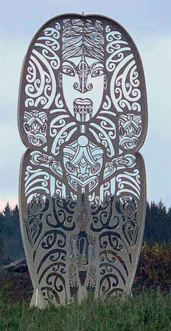
Hinetapuarau - SH2
|
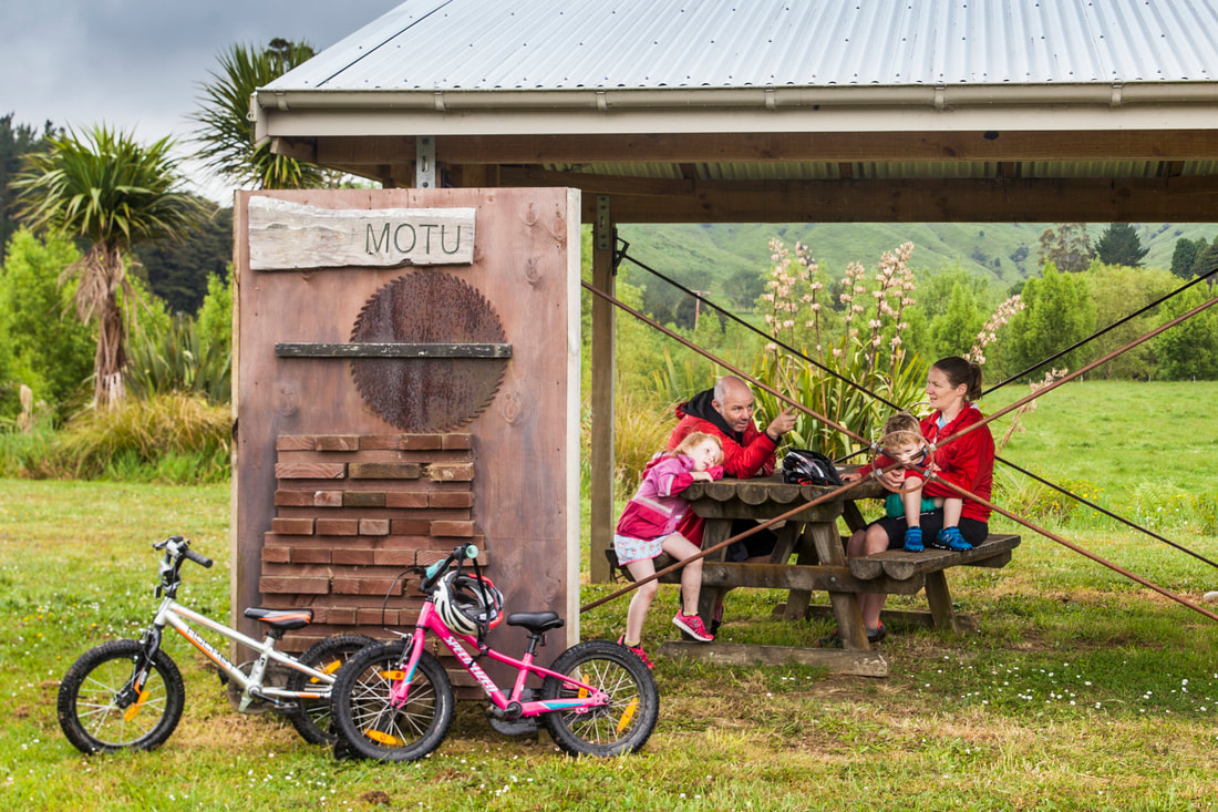
Family rest stop at Motu. - Mead Norton

The Motu Challenge Race
|
|
Showgrounds Park Motor Camp
20 Main Rd, Makaraka. Gisborne’s very own cycle hub holiday park. P: 06-867 5299 E: [email protected] |

|
Visit Sunshine Brewery
49 Awapuni Rd, Gisborne. Open for tastings. Bar service & pizza available. |

Manganuku Bridge & DOC Campground
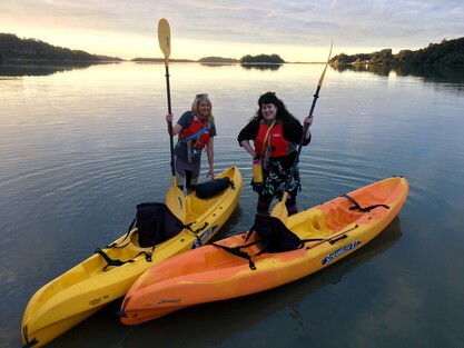
Moonlight Kayaking with KG Kayaks
|
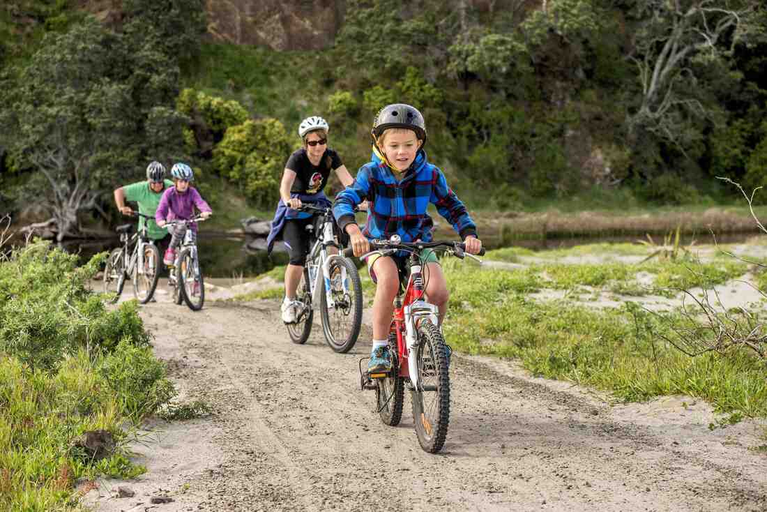
A family day out on the Motu Trails
|