Matawai
Matawai is a small rural settlement with a store, cafe, camp, art gallery and service station. Matawai is also one of the start points of the MOTU TRAILS CYCLEWAY one of New Zealand’s “22 Great Rides”. Before you leave the area turn left in the village and visit Motu (14kms from Matawai) where you will find Motu-Vation Café and Motu Community House and the Motu Falls.
Matawai is a small rural settlement with a store, cafe, camp, art gallery and service station. Matawai is also one of the start points of the MOTU TRAILS CYCLEWAY one of New Zealand’s “22 Great Rides”. Before you leave the area turn left in the village and visit Motu (14kms from Matawai) where you will find Motu-Vation Café and Motu Community House and the Motu Falls.

OPOTIKI to GISBORNE via the Waioweka Gorge
For the PACIFIC COAST HIGHWAY ROUTE TO GISBORNE – SEE PAGES 45 TO 63
|
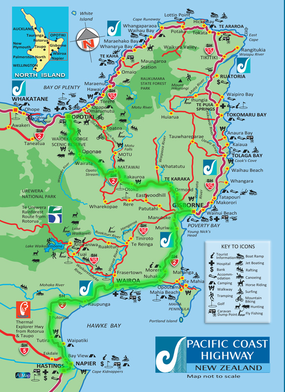
The Waioeka Journey – Te Awa a Tamatea is situated on State Highway 2 between Ōpōtiki and Gisborne. The highway follows a route carved by rivers through the steep forested hills of the Waioeka Gorge Scenic Reserve. The trip from Ōpōtiki to Gisborne can probably take about two and a half hours but by picnicking or generally messing around anywhere in the delightful bush setting of the gorge the trip can profitably be made to last many hours longer. To start follow State Highway 2 south along St John Street, past the cemetary, continue to the right then you come out onto the Waioeka Flats. This straight road continues until the settlement of Waioeka and the entry into Waioeka Gorge Scenic Reserve (New Zealand’s largest scenic reserve). The gorge has many idyllic picnic spots and can be a fisherman’s paradise when the fish are biting. ‘The Waioeka Journey – Te Awa a Tamatea’, is a multi-agency project where seven rest areas have been established at sites through the gorge to encourage travelers to stop, rest and reduce driver fatigue, a
significant contributor to Waioeka accidents. Information panels at each site tell of the history, culture, geology and ecology of the gorge. Stories of the Waioeka Gorge show it is not a place to be taken for granted, but has hidden depths that will delight and challenge people for generations to come. A place with tales of hardship, ingenuity and adaption. Each of the sites has its own story to tell. The two main agencies have been The New Zealand Transport Agency www.nzta.govt.nz and the Department of Conservation. www.doc.govt.nz. View the Waioeka Journey Booklet |
|
Tauranga Bridge – Barbara Collett
|
|
|
Wairata
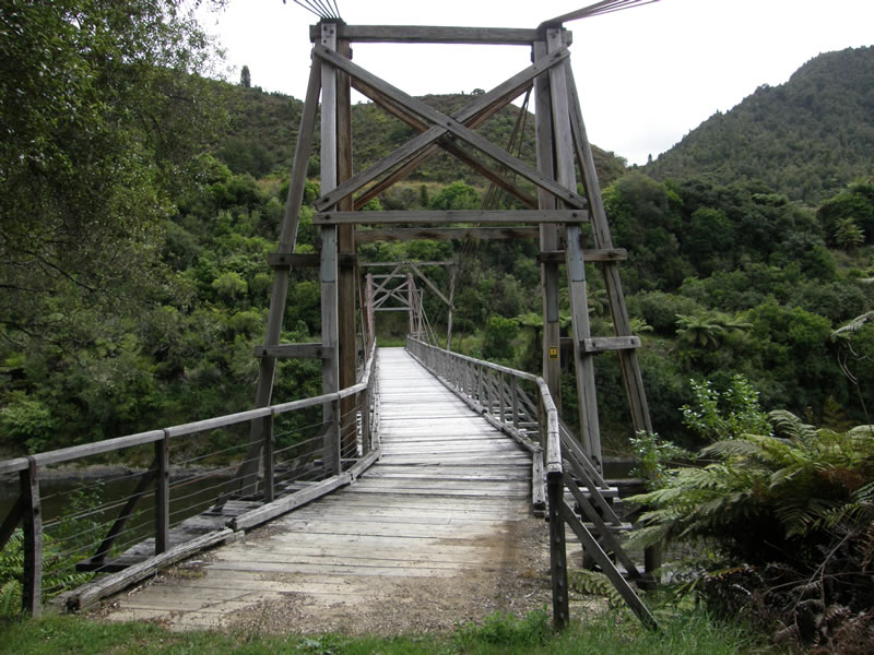
The Waioeka River turns south at Wairata and the main road follows the Opato Stream. Living Water Bush Café
Enjoy organic coffee & home baking on the banks of the Opato Stream. Local produce – nuts & honey available. P: 07-315 7422 |
|
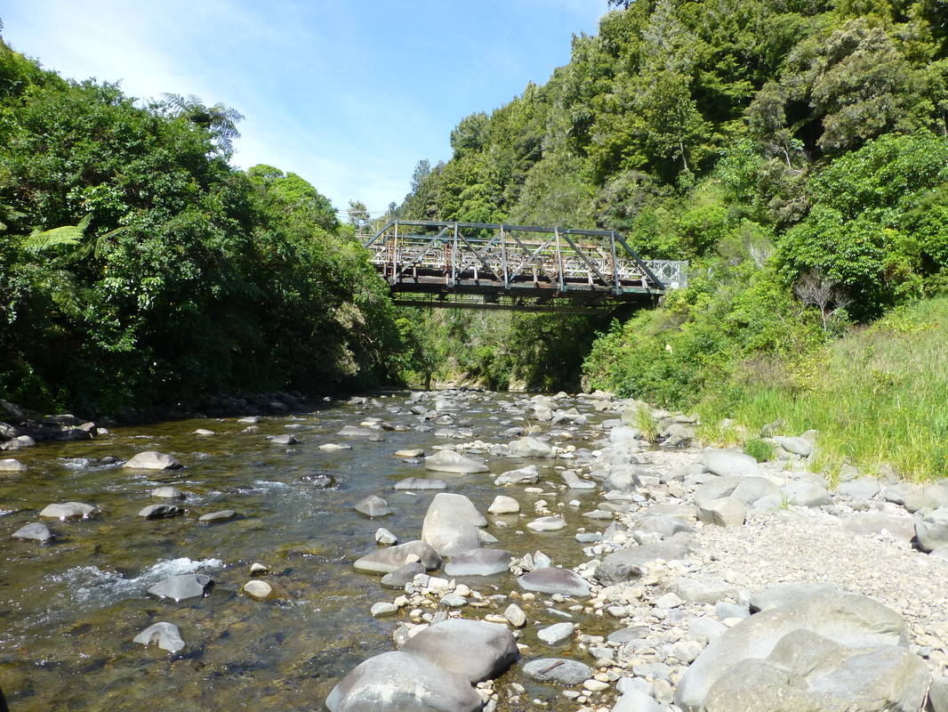
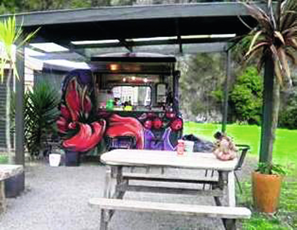
Manganuku Bridge & DOC Campground
|
|
We hope that you enjoyed THE WAIOEKA JOURNEY
Soon after the road starts to climb out of the gorge and wind its way up over Traffords Hill, at 725 metres the high point in the trip. Just after you cross the bridge and the head waters of the Motu River, a right turn on Te Wera Road would take you through even more scenic back country roads and on to Wharekopae, Rere Falls & Eastwoodhill Arboretum joining SH2 again south of Gisborne. One and a half kms from the SH2/Te Wera Road intersection is the Moanui Road turn off to Moanui - Koranga - Tawa Loop Track or continue on the main road to Matawai.
|
Matawai
Matawai is a small rural settlement with a store, cafe, camp, art gallery and service station.Matawai is also one of the start points of the MOTU TRAILS CYCLEWAY one of New Zealand’s “22 Great Rides”. Before you leave the area turn left in the village and visit Motu (14kms from Matawai) where you will find Motu-Vation Café and Motu Community House and the Motu Falls. |
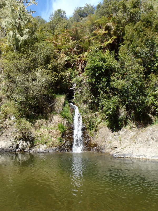
Waterfall near Moanui
|
|
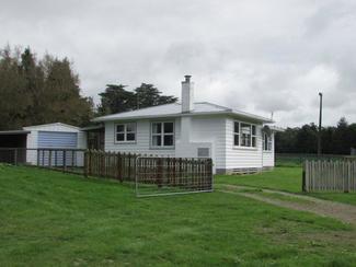
Glen-Lyon Farm Stay Cottage
2.5 Kms south of Matawai on State Highway 2. Sleeps 6 (one double) Self Cater, Full kitchen available. Bookings through Airbnb. For further information contact Leone. P: 06 8624852 E: [email protected] |
MOTU VILLAGE & MOTU FALLS SIDE TRIP
Or return trip to Ōpōtiki via Motu Road Scenic Drive (see page 38 for Scenic Drives). Motu Village is 14km from Matawai. Motu is a very well established and productive farming community. Special Attractions include Motu Falls (5kms from Motu Village) and the Whinray Reserve Bush Walk which is an easy two hour walk along the old Military Track. This is not a loop track, but there is vehicle access from each end – the other end is on Marumoko Road – off the old Motu Road. Other activities are mountain biking (including Motu Trails, part of the New Zealand Cycle Trail) and trout fishing.
Or return trip to Ōpōtiki via Motu Road Scenic Drive (see page 38 for Scenic Drives). Motu Village is 14km from Matawai. Motu is a very well established and productive farming community. Special Attractions include Motu Falls (5kms from Motu Village) and the Whinray Reserve Bush Walk which is an easy two hour walk along the old Military Track. This is not a loop track, but there is vehicle access from each end – the other end is on Marumoko Road – off the old Motu Road. Other activities are mountain biking (including Motu Trails, part of the New Zealand Cycle Trail) and trout fishing.
|
Motu-Vation Café
High Country Refreshment at 1308 Motu Rd. Motu. Open Friday, Saturday, Sunday. 10-4. See us on Facebook |
|
Motu Community House
Self-catering accommodation (for up to 9 people) on the Motu Trails. 18 Motu Falls Road, Motu. P: 06-862 8736 or 06-863 5804 E: [email protected] or [email protected] W: www.motutrails.co.nz |
On leaving Matawai the road to Gisborne follows the old railway track down through some majestic hill country that borders Te Urewera. On the right, approximately 18kms from Matawai you will come across Makaretu Road where you will find Haurata High Country Retreat and Farm Walks.
|
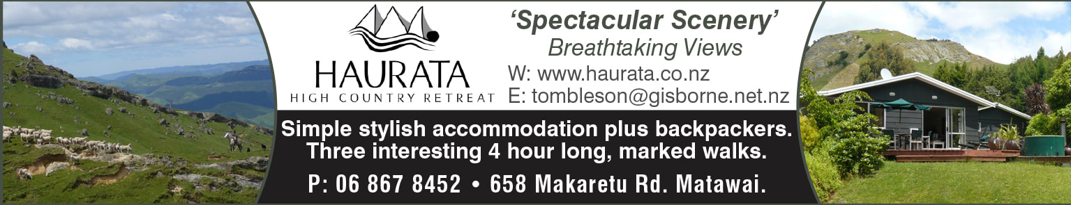
Haurata High Country Retreat and Farm Walks
Experience Gisborne’s most spectacular scenery and accommodation. 658 Makaretu Rd, Otoko. P: 06-867 8452 E: [email protected] W: www.haurata.co.nz |
Otoko
This is the western end of the Heritage Trail Walkway. The 5km walkway follows the old Gisborne to Motuhora railway, taking 2–3 hours walk, suitable for all ages. Closed 1 August – 23 October for lambing.
This is the western end of the Heritage Trail Walkway. The 5km walkway follows the old Gisborne to Motuhora railway, taking 2–3 hours walk, suitable for all ages. Closed 1 August – 23 October for lambing.
Te Karaka
A turn off the main highway takes you on a loop of the original main highway through the village of Te
Karaka. Here about half a kilometre along you will find Gas Te Karaka. There is also a well-stocked country Butcher Shop.
A turn off the main highway takes you on a loop of the original main highway through the village of Te
Karaka. Here about half a kilometre along you will find Gas Te Karaka. There is also a well-stocked country Butcher Shop.
|
Gas Te Karaka: Rangatira Motors & Dairy
Friendly Service Station. 24/7 Fuel. Food, Lotto, Postal Agency, Well stocked shop. P: 06 862 3635 |
Carry on the loop takes you back onto SH2 again. A further 300 metres along the main road from the Te Karaka entrance/exit you will find Riverview Treks & Pinehollow Horse and Pony Rides.
|
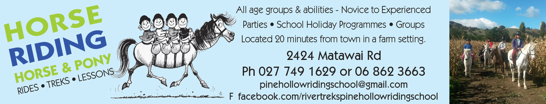
Riverview Treks & Pinehollow Horse & Pony Rides
Treks & lessons. 2224 Matawai Rd. P: 027-749 1629 or 06-862 3663 |
Makaraka
Directly in front of you as you arrive in Makaraka is the Roseland Tavern. A left turn here takes you into Gisborne and around the East Cape. A right turn leads to Wairoa and Napier.
Directly in front of you as you arrive in Makaraka is the Roseland Tavern. A left turn here takes you into Gisborne and around the East Cape. A right turn leads to Wairoa and Napier.
|
Roseland Tavern
Great family meals & takeaways, Garden Bar, BBQ, Big Screen. Bottle Store, 108 Main Rd, Makaraka, P: 06-867 8315 |
|
Showgrounds Park Motor Camp
20 Main Rd, Makaraka. Gisborne’s very own cycle hub holiday park. P: 06-867 5299 E: [email protected] |